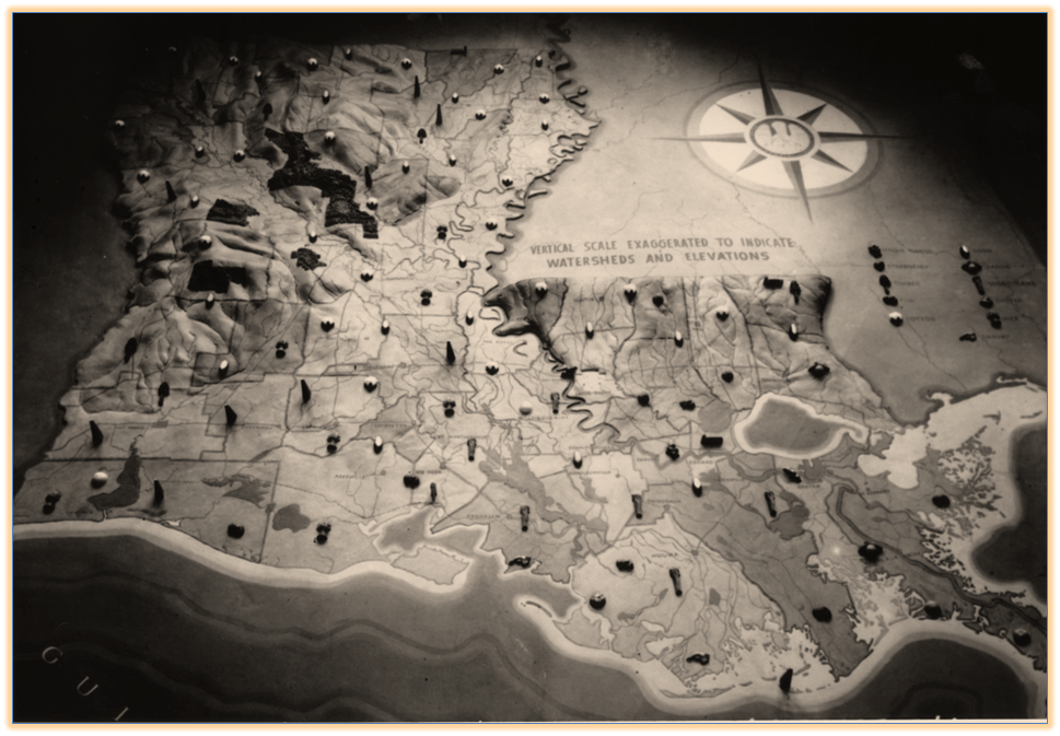
Early photograph of the map, 1939
National Archives and Records Administration
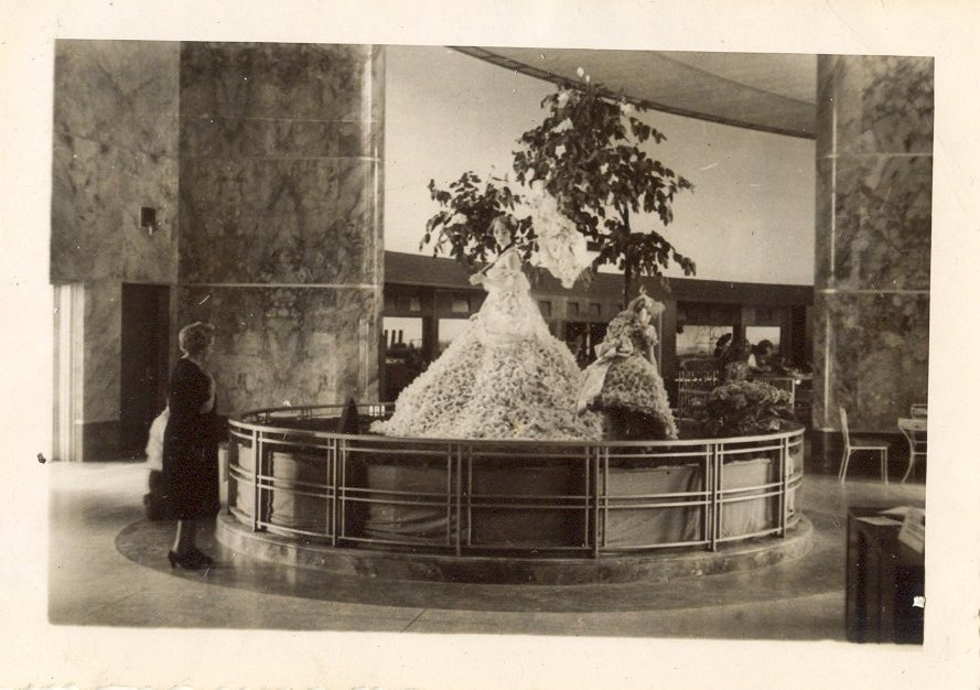
Festival display over map at LSEM, 1950s
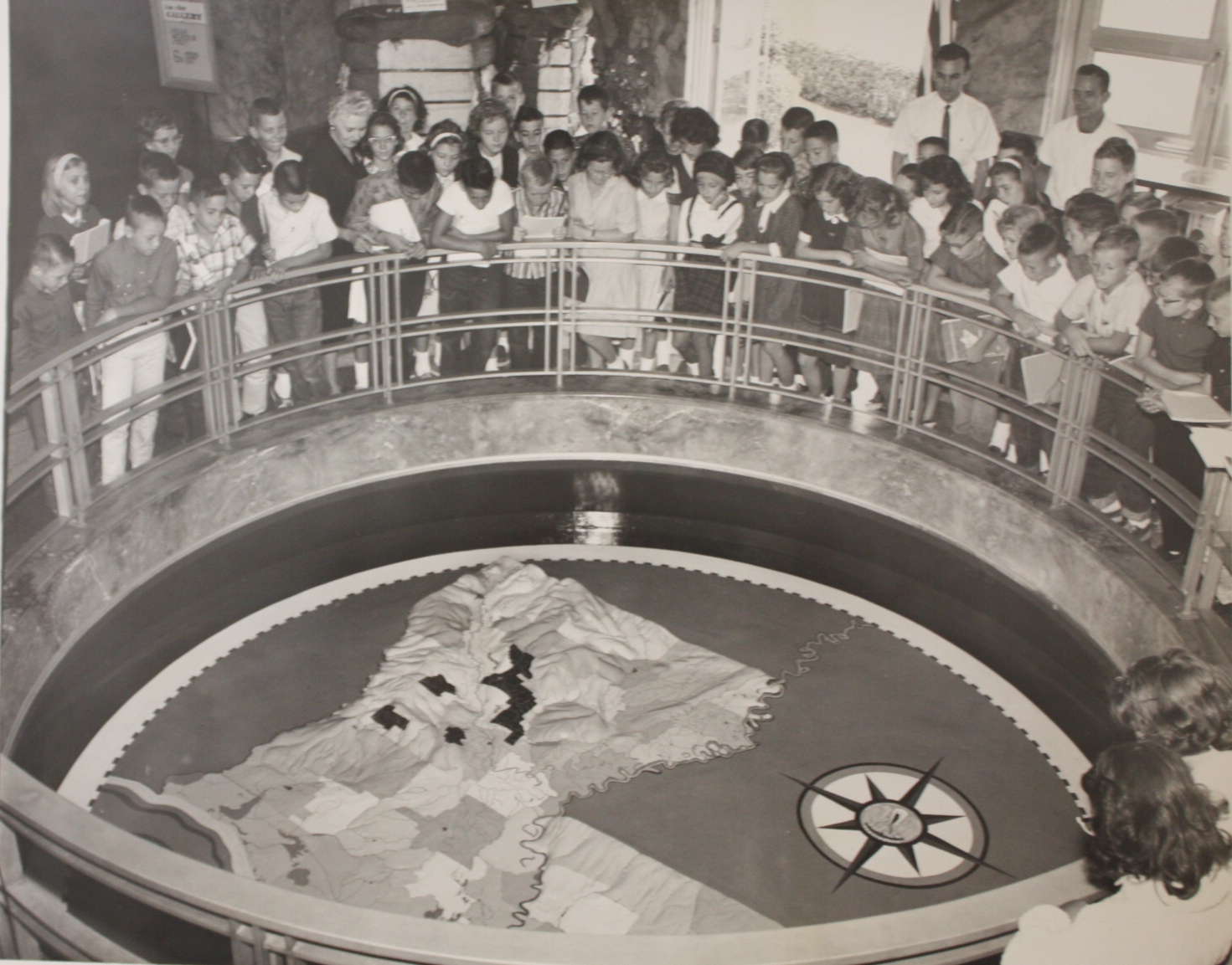
Southern Hills Elementary students visit the museum in September 1963 and view a freshly repainted surface. Photograph by a Shreveport Times Staff Photographer.
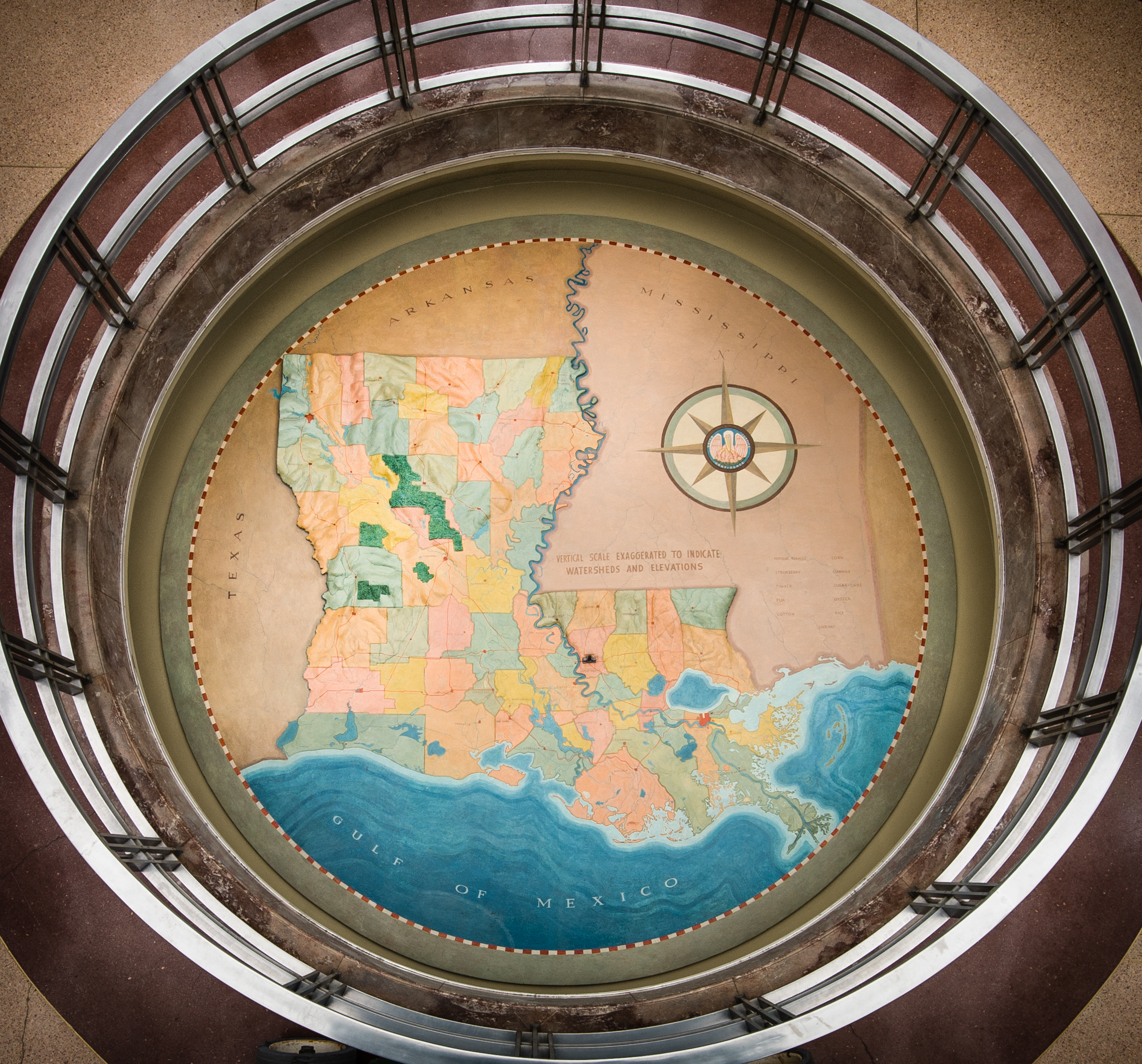
Sculptor Duncan Ferguson created LSEM’s topographical map, located three feet below the floor and just inside the entrance to the museum, while the museum was under construction. Ferguson also sculpted bronze panels at LSU, a stone bas-relief at the Louisiana state capitol, and the Lady of the Mist fountain at Ruston’s Louisiana Tech University. From 1939 through 1941, Duncan Ferguson served as the director of the LSU Art Department, with Conrad Albrizio on the faculty.
Four art students, under Ferguson’s supervision, completed the 15 foot diameter colored relief map of Louisiana composed of plaster of Paris panels. To insure accuracy of the topography, Ferguson used the United States Geological Survey (USGS) maps that show the respective elevations of areas within Louisiana. Ferguson’s map illustrates the state’s sixty-four parishes, their agricultural and industrial products, the state’s waterways, forests and natural resources.
Over the years, the map’s location proved an attractive place to create raised platforms for shows and displays. Photographs from the 1950s show two finely dressed mannequins standing on a stage placed on top of the map. The 2008 film, Mad Money, used the museum as a filming location, covering the map with a security desk placed on a platform behind the map’s three foot railing.
Age and use damaged the map over time. When staff repainted the map, it was also updated. In the 1960s, exhibit staff Steve Sanchez added the newly built Interstate highway and more plaster icons to the map. The oldest pictures of the map show 11 different icons representing the state’s resources at the time. Photographs in the 1960s show as many at 19 icons.
Conservation in 2005
By 2005, the map was in poor condition. Three professional conservators worked on the project, along with eight Art Conservation graduate students from the University of Delaware at Winterthur. Shelley Reisman Paine, who served as sculpture conservator and project Director, James Bernstein, Richard Wolbers, and the students completed the project over the course of two summers.
During the restoration, the conservators removed nine coats of over paint and varnish collected from more than 60 years of repairs. Prior to conservation, the map appeared dark and glossy, however conservators discovered the original paint layers were a soft pastel color similar to the Albrizio frescoes on LSEM’s front porch. At the lowest paint level, the conservators uncovered several icons painted directly on the map. Paint cross-sections identified the painted icons as original, with the 3-D plaster icons added later.
Read the conservators published report to learn more about the Map restoration.


LSEM’s Topographical Map as it looks today
Photo by Brian Lewis